A few weeks ago, the class went on a three-hour bus tour of the Atlanta Beltline project, which is currently in progress. I had previously been on the same tour a few years ago in 2009, but it was still just as exciting this time as it was then! So much has happened to the area since then. It's amazing to see change happen so quickly, and anticipate how much more change will be coming in the next years.
Ryan Gravel explaining the Beltline
a map of the Beltline corridor: transit, trails, & walking distance
a bird's-eye view of it from the northeast, facing toward the southwest
a concept map of all transportation projects in Atlanta
Here are some of the things I learned from the tour:
- The idea for the Beltline (which was a graduate thesis project by Ryan Gravel at Georgia Tech in 1999) was spurred by his experience observing rail infrastructure in Paris, France...most likely referring to the Paris Tramway loops on the outer edge of the city)
map of current & proposed Paris Tramway lines
- The Atlanta Beltline is the largest urban redevelopment project in the United States
- There are 47 schools in total which are located within walking distance of the Atlanta Beltline corridor, 4 of which are high schools.
- The Historic Fourth Ward Park, which is already completed and opened, contains a storm water retention pond. (The area is one of the lowest in Atlanta, making it prone to major floods.)
Historic Fourth Ward Park retention pond
- The 33 miles of trail, 22 miles of light-rail transit, and 2000 acres of park space will connect 45 intown Atlanta neighborhoods.
DH Stanton Park is one of the many parks to be constructed
- The project focuses on "reusing" 4 historic railway lines which formed a small loop to detour downtown Atlanta in the days of freight shipping, most of which are abandoned and no longer used.
a section of the unused railway on the east side
- The redevelopment project of the Beltline addresses: population growth (Atlanta is the 2nd fastest growing metro area in the United States), traffic congestion, and unequal commercial investment in the southern and western sections of the city proper.
a neglected section of the formerly-Industrial Atlanta
- The Bellwood Quarry, which is on the Beltline trail, will become the largest park in Atlanta and the quarry will become a lake for recreational purposes as well as an emergency water supply for the city.
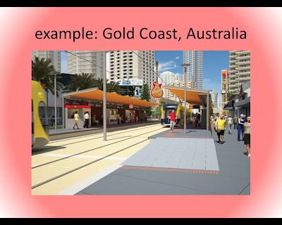
I gave a presentation to the class this past week on transit-oriented development and green urbanism. Since it is on the same topic of the Beltline (since it is a Green TOD project itself) I thought that I would share the PowerPoint slides with anyone else not in the class. Enjoy:
Dear prof. Nicoara, thank you very much for this most useful post. I work with similar issues at my Chair (Architecture and Information Technology) at Sapienza Rome. We have done several publications on our projects (unfortunately only projects) for Rome. From this link you and your students can access a lot of information (several projects and Publications) http://www.arc1.uniroma1.it/saggio/ugl/ in particular an issue of L'Arca Magazine (english italian franch) dedicated to our proposal The urban green line. I hope to have occasion to exchange experiences. Many thanks and best regards for this post prof. Antonino Saggio AntoSAG@Gmail.com


Dear prof. Nicoara, thank you very much for this most useful post. I work with similar issues at my Chair (Architecture and Information Technology) at Sapienza Rome. We have done several publications on our projects (unfortunately only projects) for Rome. From this link you and your students can access a lot of information (several projects and Publications) http://www.arc1.uniroma1.it/saggio/ugl/ in particular an issue of L'Arca Magazine (english italian franch) dedicated to our proposal The urban green line. I hope to have occasion to exchange experiences. Many thanks and best regards for this post prof. Antonino Saggio AntoSAG@Gmail.com
ReplyDelete